BY LETTER
Maps of the Terragen Sphere
The Orion Arm and Proximity | |
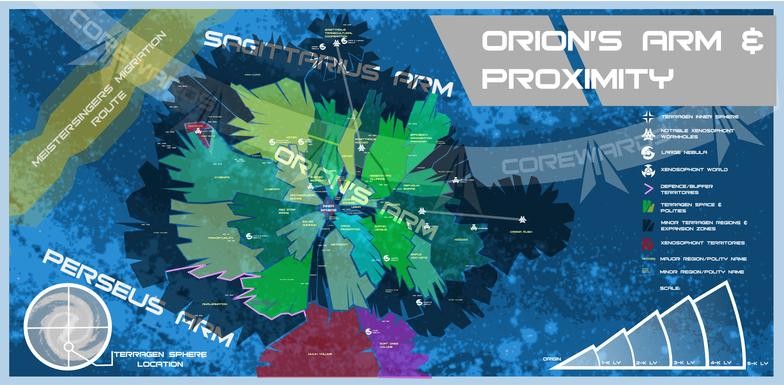 Image from Phil B | |
| An artistic interpretation of the Empires and other volumes within the Orion Arm and environs. Although the borders between the empires are displayed as discrete limits in this interpretation, in practice the various empires merge into one another and change over time as the various systems change allegiance. Note as well that this two-dimensional representation does not show the full extent of empires which overlay one another - the Red Star M'Pire overlays the much larger Solar Dominion, for instance, and the Mutual Progress Association and the Keter Dominion are similarly stacked one above the other | |
Milky Way Galaxy | |
.PNG) Image from The Astronomer, MiyuwiAuthor, adapted from an ESA image | |
| This map shows the spiral arms of the Milky Way galaxy and the location of the Terragen Sphere, as well as the location of HEEC-MW-1 and the various MEEC civilisations in this galaxy. | |
The Milky Way has been extensively mapped by the Argus Array, and (apart from the Terragen Sphere) several civilisations have been discovered, including one other HEEC (High Energy Emission Civilisation), thirteen MEECs and (currently) 131 LEECs and several possible NEECS. Note that, in practice, it is difficult or impossible to determine the difference between a Null Energy Emission Civilisation and an ordinary life-bearing world with no civilisation, although sometimes there are intriguing indicators of sentience; note as well that these numbers are subject to change as civilisations rise, fall, or become stealthy.
The Terragen Sphere as seen from Galactic North
showing the locations of all major star cluster and Outer Volumes Political Regions.The Terragen Sphere as seen from Galactic North |
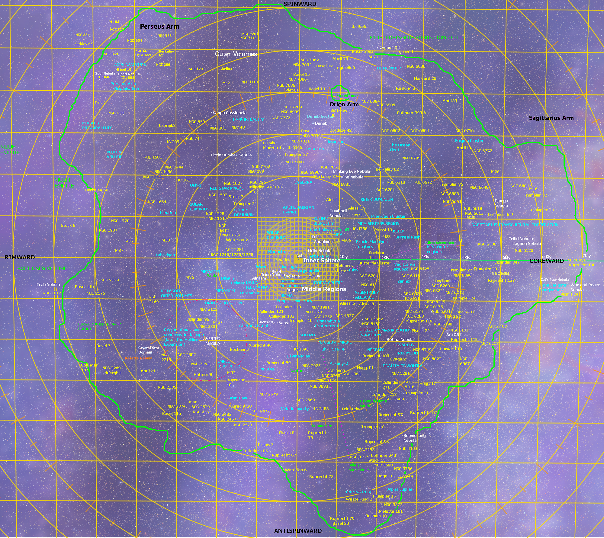 Image from Steve Bowers |
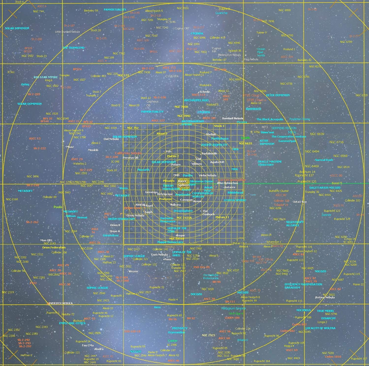 Image from Steve Bowers |
A map of the Middle Regions out to three thousand light years in radius
A clickable version of this map can be found here Warning; large file- 2.6 megs
The Middle Regions - Celestia Image |
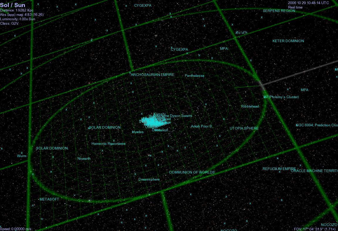 Image from Steve Bowers |
Another view of the Middle Regions, as seen from a different angle
The Inner Sphere |
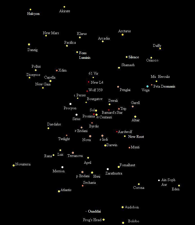 Image from Steve Bowers |
(click for more detailed image).
Inner Sphere from Galactic North |
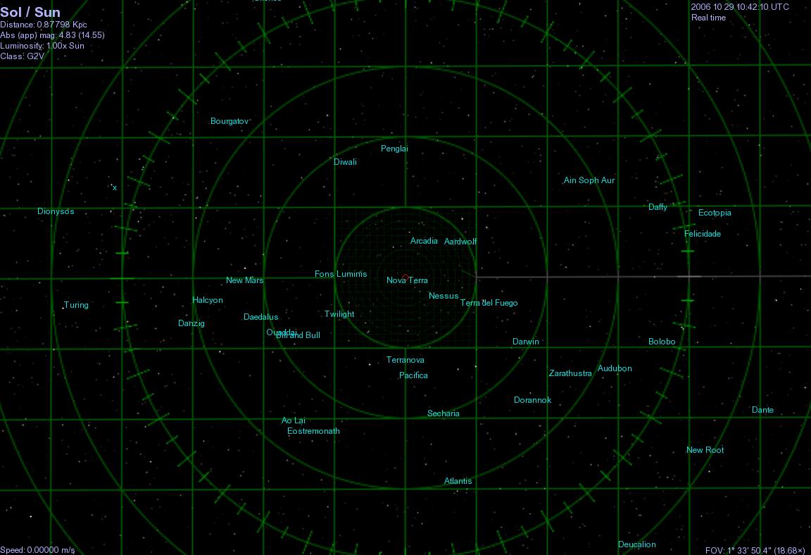 Image from Steve Bowers |
Inner Sphere from another Angle |
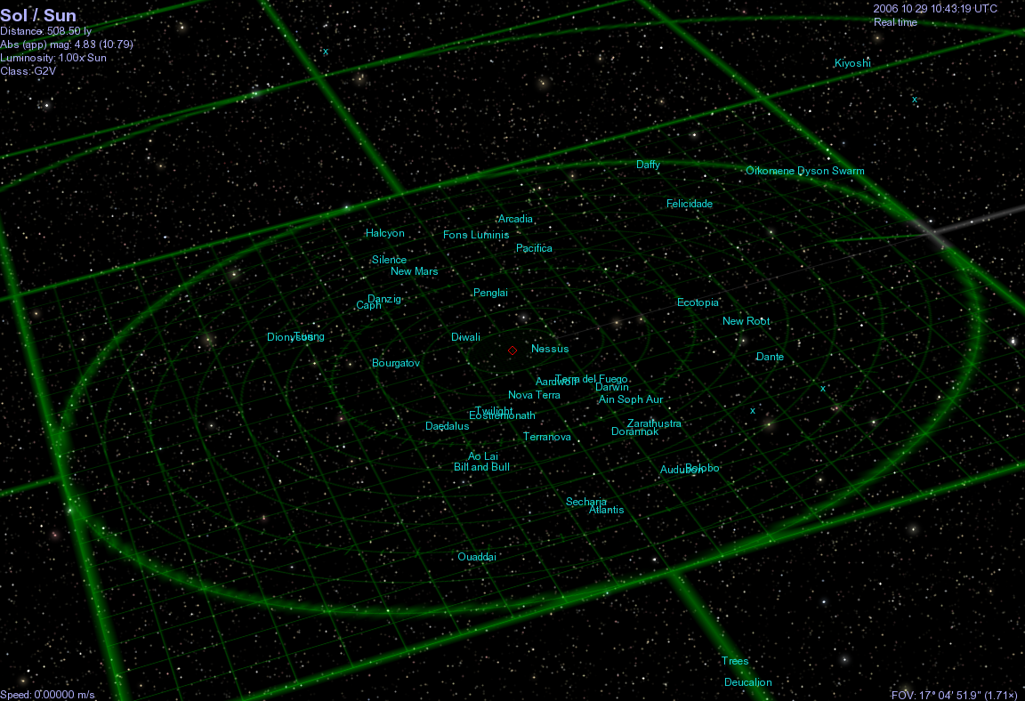 Image from Steve Bowers |
This view shows the Inner Sphere from a viewpoint above the Galactic plane and to rimward and counterspinwards of Sol. The location of Sol is marked by a red diamond.
See Also
Maps of the Galactic Plane as seen from Old EarthPolitical Maps of the Middle Regions in the year 8000 A.T.
These maps corresponds to slices of the galactic plane, separated by planes 200 ly apart. The distance of the camera from Sol is 5000 ly.Northernmost Slice |
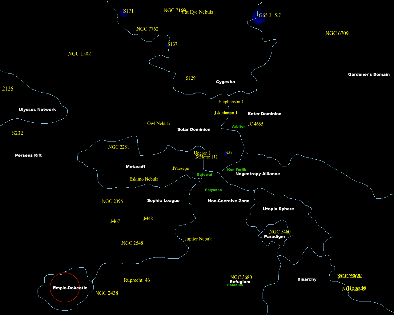 Image from Anders Sandberg |
Northern Middle Slice |
 Image from Anders Sandberg |
Southern Middle Slice |
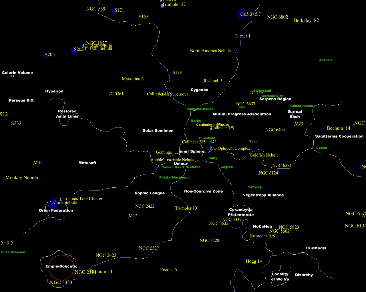 Image from Anders Sandberg |
Southernmost slice |
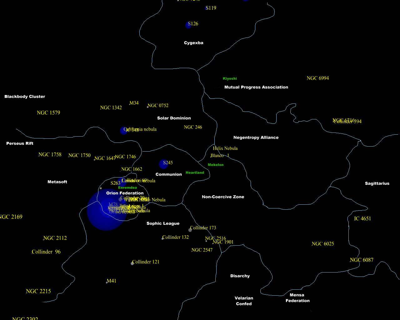 Image from Anders Sandberg |
The Big Picture
Shows the Outer volumes and the periphery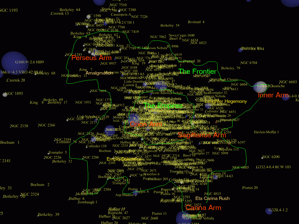 Image from Anders Sandberg |
The Galactic Plane
image of the Terragen Sphere from the side Image from Anders Sandberg |
More maps of the Terragen Sphere by Anders Sandberg
A number of older maps of the Terragen Sphere can be found on this pageArticles
- Astrogation, Astronavigation - Text by M. Alan Kazlev
Plotting a course for a ship through interplanetary and interstellar space. - Astrography - Text by Anders Sandberg
Interstellar cartography, determining one's position in space, naming of interplanetary and interstellar bodies and regions, the science of interplanetary and interstellar map-making. - Bubble (galactography) - Text by M. Alan Kazlev
The extent to which a starfaring civilization has expanded through interstellar space. - Cartographer - Text by M. Alan Kazlev
One who creates, studies or interprets maps. - Cartography - Text by M. Alan Kazlev, modified from the original write-up by Robert J. Hall
The making and reading of maps. - Core Worlds - Text by M. Alan Kazlev
The Sol system and neighboring systems which were the first colonized by
Terragens. - Galactic Core - Text by M. Alan Kazlev
The dense central region of a galaxy. The central region of the Milky Way, like many other galaxies, is densely crowded with stars, pulsars, white dwarfs, and other objects. It contains a massive central object, Sagittarius A*. - Galactic Directions - Text by Anders Sandberg, amended by Steve Bowers
Planetary terms like north, south, east, west, are insufficient for referring to directions within the galaxy. Instead, the a different set of conventions have achieved widespread acceptance when referring to direction. - Light Speed Frontier - Text by Thorbørn Steen
The outer edge of the Terragen Sphere. - Maps of the Galactic Plane - Text by Steve Bowers
The Terragen Civilisation as seen from Old Earth - Maps of the Orion Arm - Text by Originally made by Anders Sandberg 2002
A series of maps zooming in on the vicinity of Sol in the Orion Arm. - Milky Way - Text by M. Alan Kazlev
The spiral galaxy in which we live. - Sagittarius A* - Text by M. Alan Kazlev
Supermassive black hole in the centre of the Milky Way. It is surrounding by concentric rings of rapidly expanding matter, evidence of a massive explosion. - Stars near Sol - Exploration and Colonisation - Text by Arik
Early exploration efforts in the Solar Neighborhood. - Terragen - Text by M. Alan Kazlev
Any biont, ai, or any other entity, clade, species, or group that either originated on Earth or, more generally, can trace eir ultimate origin and ancestry back to Earth; or any civilization, empire, polity or organization created or maintained by terragen sentients. - Terragen Expansion - Text by Anders Sandberg amended by Steve Bowers
The expansion of the Terragen Sphere over time. - Terragen Sphere - Text by Stephen Inniss
The region of the galaxy that has been colonized or explored by Terragen sophonts.
Related Topics
Development Notes
Text by Steve Bowers and Anders Sandberg
Initially published on 01 January 2007.
Initially published on 01 January 2007.
Additional Information